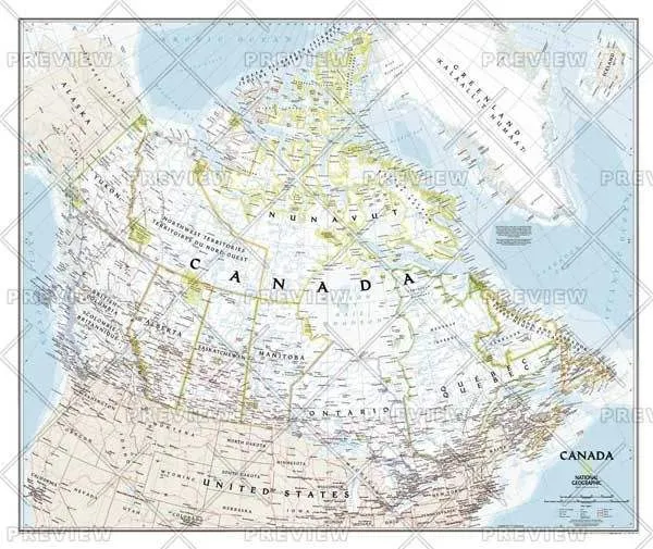
This classic-style wall map of Canada features thousands of place names, accurate political boundaries, national parks, archeological sites, and major infrastructure networks such as roads, canals, ferry routes, and railroads. Canada's diverse terrain is detailed through accurate shaded relief, coastal bathymetry, and symbolism for water features and other landforms. It depicts Canada and the areas surrounding the Great Lakes. Includes Canadian provinces and US State boundaries.
Cart(0)


")


