


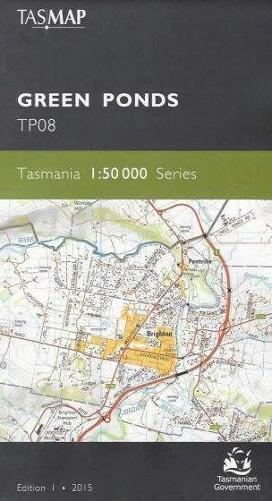
This map covers the rural and ever expanding rural/residential areas north of Bridgewater as far as Melton Mowbray and includes the towns of Brighton, Bagdad, Kempton, Colebrook and Campania.
An ideal map for people wanting to explore the many conservation areas and nature reserves characteristic of the area.
The design of the 1:50 000 Map Series provides a clear and accurate portrayal of topographic information, with symbols and map content giving enhanced depiction of buildings, hill shading and a simplified classification of vegetation.
![Raymarine i40 Bidata Display System w/Thru-Hull Transducers [E70145]](https://www.rovefit.shop/image/raymarine-i40-bidata-display-system-wthru-hull-transducers-e70145_H3Df8e_300x.webp "Raymarine i40 Bidata Display System w/Thru-Hull Transducers [E70145]")


